 Backpacking at Low Gap Trail

21 registered
If you can't drive to the GPS coordinates, then drive to
Morgan-Monroe State Forest Office
6220 Forest Rd, Martinsville, IN 46151
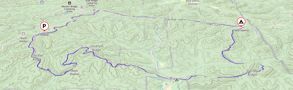
Then drive south about 1.5 mi to the Low Gap Trail parking lot (also the same parking lot for Mason Ridge Trail and Rock Shelter Trail).
The Low Gap Trail is also a 10-mile loop which begins and ends at the Morgan-Monroe State Forest near the headquarters and youth tent area. Overnight backcountry camping is allowed along the eastern-most portion of the loop.
Downloadable Items:
- Troop Created Map BEST MAP - Mr. Jackson has created with key markers
- Troop Created Topo Map BEST MAP #2 - Another Mr. Jackson creation
- Low Gap Map-Rice - Topo map of the Low Gap Trail by Steve Rice
- GPS track coordinates of the Low Gap Trail, in standard gpx format (may need to right click and choose "Save As")
- Low Gap Trails Map (poor b/w copy) from the DNR’s web
This moderate backpacking trip will be approximately 10 miles over two days. We will camp overnight on the far east side about 6 miles in, and pack out Sunday morning the remaining 4 miles back to our cars.
Each hiker is responsible for their own:
- Food (planning and packing all 3 meals - lunch, dinner, & breakfast)
- Water (will resupply near camp and on trail) with filtration
- Backpacking gear (you can borrow troop backpacks)
- Shelter (you can borrow troop tent to split between two people)
Review and study our Backpacking page for information and ideas on gear, food, and tips.